
HCV-HCS Screening Case Study: Kapuas Hulu District (Indonesia)
Over two million hectares of forest remain in Kapuas Hulu District, of which less than 40% is located inside National Parks. This means there is a significant amount of forest, supporting biodiversity conservation, ecosystem services and support for local livelihoods, that is potentially at risk.

About the jurisdiction
Over two million hectares of forest remain in Kapuas Hulu District, of which less than 40% is located inside National Parks. This means there is a significant amount of forest, supporting biodiversity conservation, ecosystem services and support for local livelihoods, that is potentially at risk.
In 2020 Kapuas Hulu became a member of the Sustainable District Association (LTKL in Bahasa Indonesia). LTKL is a collaboration forum of District Governments and development partners committed to green growth objectives and sustainable development.
The German Development Cooperation collaborated with the Kapuas Hulu District government to implement a jurisdictional approach to sustainable supply chains and economic development while minimizing the risk of deforestation and destruction of biodiversity and habitats. The Initiative for Sustainable Agricultural Supply Chains supports work on deforestation-free and sustainable supply chains for agricultural commodities such as oil palm and rubber.
Key facts:
- Area: 29,842 km2
- UNESCO Biosphere Reserve
- Member of LTKL (Sustainable Jurisdiction Network of Indonesia)
https://www.youtube.com/watch?v=UJoHTAym3Ug
A practical example - HCV-HCS Screening implementation in Kapuas Hulu, West Kalimantan
Objective
The German Development Cooperation commissioned a jurisdictional screening for Kapuas Hulu District, in collaboration with the Kapuas Hulu government, to identify and address risks to sustainability in the landscape.
The objective of the screening was to understand where High Conservation Values (HCV) and High Carbon Stock (HCS) forests are situated, what the likely threats are to these areas, and which of these areas are most at risk. The focus was on the APL areas – or zones outside the state forest areas where commodity production is occurring and may expand.
Joint HCV and HCS screenings (i.e., large-scale indicative mapping)
The HCV and HCS approaches are often used together to identify areas important for conservation and livelihoods. Coordinating the use of both approaches brings efficiencies (e.g., when data can contribute to both HCV and HCS forest identification results and stakeholder consultation can be done simultaneously). By using both approaches together in landscapes and jurisdictions companies, conservationists, and other stakeholders can aim to identify and conserve more of the potential values present. Joint screening considers the likelihood that values are present, conducts indicative mapping and information gathering. It then analyses the possible threats to those HCVs and HCS forest and provides results to spark discussion, make recommendations and prioritize actions.
The work involved
HCV Network led a team of experts from Daemeter Consulting and Tropenbos Indonesia to conduct an HCV-HCS screening exercise to characterize the environmental and social aspects of the jurisdiction.
The screening results included indicative maps, a report, a short film and compiled information. These results were presented to stakeholders through a series of virtual workshops.
For the social HCVs (5-6) emphasis was placed on generating descriptive information on social HCVs and risks and gathering recommendations for next steps.
Key findings
Indicative maps of environmental HCVs (1-4) and HCS forests show that these conservation features cover most of the district with high degrees of overlap. HCVs and HCS forests are most at risk in areas that are allocated to agricultural land use and production forest.
Environmental HCVs in Kapuas Hulu include habitats for threatened species like the orangutan, peatlands, several types of forests, wetlands and peat swamps, habitat corridors, and critical ecosystems that provide services such as natural fire breaks and flooding controls.
Due to the high forest dependency of communities, all of Kapuas Hulu district is likely to have social HCV values, and although there are several threats, the impacts of oil palm development figures as the most frequently cited high-impact threat. An FPIC (Free, Prior and Informed Consent) process is essential to validate the indicative social HCV map and to build on the report findings.
What next?
The screening results provided important information for district spatial planning, for meeting the district’s sustainability objectives, and for sustainable sourcing and initiatives for rubber and oil palm farmers.
The screening results (and underlying data) can be used to support BAPPEDA and other government departments:
- in the preparation of future jurisdictional sustainability reports,
- for spatial planning,
- for regional development plans (RPJMD) and the Strategic Environmental Assessment,
- as a member of the Lingkar Temu Kabupaten Lestari (LTKL–Sustainable District Association) to design the development scenario portfolio following the regional competitive framework (KDSD),
- for the allocation of concessions such as oil palm, mining, etc.
One key recommendation is that there needs to be a coordinated approach that engages with government, private sector, NGO and community actors in the district. This is necessary to define the conservation and development objectives and to determine strategies and responsibilities necessary to achieve these objectives. Examples of these objectives are the allocation of oil palm concessions, requirements for plantation-level safeguards, participatory mapping and recognition of customary rights, and habitat restoration.
To learn more about this case study, HCV screening and learning opportunities, or to collaborate with the HCVN Secretariat, contact secretariat@hcvnetwork.org
Related Posts

Interview with Erik Meijaard: Bridging the Gap: How Citizen Science Can Strengthen HCV Implementation
Read More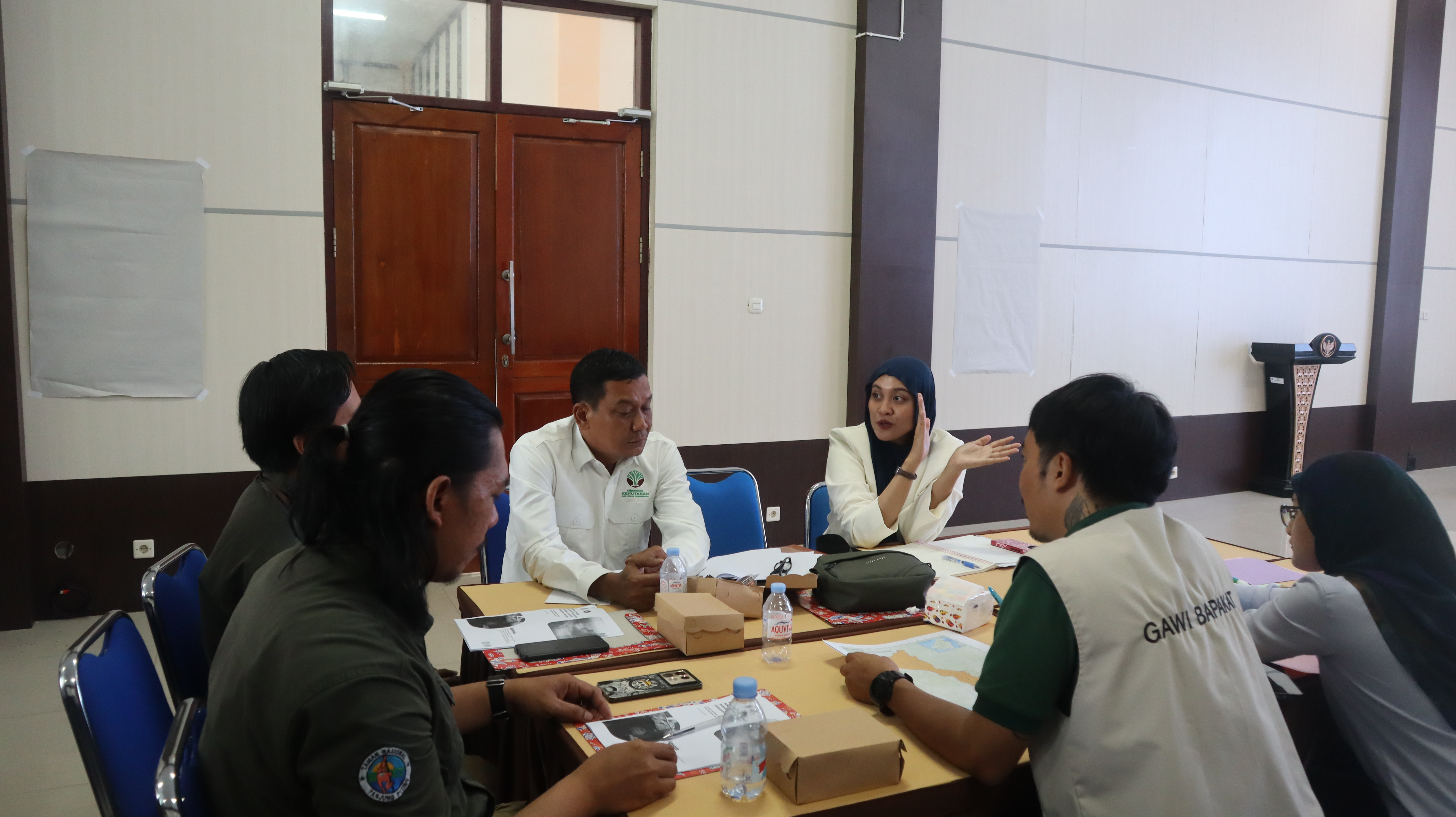
Menjembatani Teknologi dan Konservasi: Refleksi Project Manager HCV Network, Mirzha Hanifah, dari Tiga Inisiatif Lanskap di Indonesia
Read MoreBridging Technology and Conservation: Reflections from HCV Network’s Project Manager Mirzha Hanifah on her work in three landscape initiatives in Indonesia
Read MoreOur Partnerships
Alongside many global initiatives, our work with partners promotes practices that help meet the global Sustainable Development Goalsand build a greener, fairer, better world by 2030.
Femexpalma
In April 2022, FEMEXPALMA and the HCV Network signed a 5-year cooperation agreement to promote sustainable production of palm oil in Mexico. FEMEXPALMA is a Mexican independent entity that represents palm production at the national level and promotes the increase of productivity in a sustainable way.
With global markets becoming stricter, for Mexican producers to be able to export to key markets such as the European Union, they must meet strict requirements such as certification by the Roundtable on Sustainable Palm Oil (RSPO). To be certified by RSPO, the HCV Approach must be applied prior to the establishment of any new oil palm plantations. With this cooperation agreement, the HCV Network will support FEMEXPALMA’s members and allies to design better strategies to identify, manage and monitor High Conservation Values and support smallholders to achieve RSPO certification and implement good agricultural practices.

High Carbon Stock Approach
The High Carbon Stock Approach (HCSA) is an integrated conservation land use planning tool to distinguish forest areas in the humid tropics for conservation, while ensuring local peoples’ rights and livelihoods are respected.
In September 2020, HCV Network and the HCSA Steering Group signed a five-year Memorandum of Understanding (MoU) to strengthen their collaboration to conserve forests and uphold community rights in tropical forests. The HCS and HCV Approaches are cornerstones of corporate no deforestation and conservation commitments, and increasingly for actors working at different scales. The collaboration aims to further support effective implementation of these commitments through increased uptake of the HCV and HCS tools.
Through this MoU, HCSA and HCVRN are pursuing two main strategic goals:
- Strive to promote the application of the two approaches in tropical moist forest landscapes and explore further opportunities for collaboration.
- Ensure that, where the two approaches are applied together, this happens in a coordinated, robust, credible, and efficient manner, so that HCS forests and HCVs are conserved, and local peoples’ rights are respected.

World Benchmarking Alliance
From May 2022, the HCV Network is an ally at the World Benchmarking Alliance (WBA). WBA is building a diverse and inclusive movement of global actors committed to using benchmarks to incentivise, measure, and monitor corporate performance on the SDGs, and will assess and rank the performance of 2,000 of the world’s most influential companies against seven systems of transformation by 2023.
The scope of WBA’s circular transformation was expanded to cover nature and biodiversity as recognition of the need for greater understanding, transparency and accountability of business impact on our environment. The WBA Nature Benchmark was launched in April 2022, which will be used to rank keystone companies on their efforts to protect our environment and its biodiversity. As HCV Areas are recognised as key areas important for biodiversity, companies that publicly disclose their actions to identify and protect HCVs will contribute to the assessment of their performance against the benchmark.
Taskforce on Nature-related Financial Disclosures - TNFD
The Taskforce on Nature-related Financial Disclosures (TNFD) is a global, market-led initiative, established with the mission to develop and deliver a risk management and disclosure framework for organizations to report and act on evolving nature-related risks, with the aim of supporting a shift in global financial flows away from nature-negative outcomes and toward nature-positive outcomes.
In April 2022, the HCV Network joined the TNFD Forum. The TNFD Forum, composed of over 400 members, is a world-wide and multi-disciplinary consultative network of institutional supporters who share the vision and mission of the task force.
By participating in the Forum, the HCV Network contributes to the work and mission of the taskforce and help co-create the TNFD Framework which aims to provide recommendations and advice on nature-related risks and opportunities relevant to a wide range of market participants, including investors, analysts, corporate executives and boards, regulators, stock exchanges and accounting firms.
Aquaculture Stewardship Council
The Aquaculture Stewardship Council (ASC) is the world’s leading certification scheme for farmed seafood – known as aquaculture – and the ASC label only appears on food from farms that have been independently assessed and certified as being environmentally and socially responsible. In 2021, the HCV Network and ASC formalised their collaboration through a Memorandum of Understanding (MoU). The MoU represents the first step in a fruitful relationship aimed at conserving HCVs in aquaculture. Although, existing guidance on the use of the HCV Approach currently focuses mainly on forestry and agriculture, the HCV Approach is however generic, and in principle also applicable to aquatic production systems. Through this MoU, this is recognised by the Aquaculture Stewardship Council (ASC) in their ASC farm standard, in which the protection of HCV areas is mentioned in the context of expansion
Accountability Framework Initiative
The Accountability Framework initiative (AFi) is a collaborative effort to build and scale up ethical supply chains for agricultural and forestry products. Led by a diverse global coalition of environmental and human rights organizations, the AFi works to create a “new normal” where commodity production and trade are fully protective of natural ecosystems and human rights. To pursue this goal, the coalition supports companies and other stakeholders in setting strong supply chain goals, taking effective action, and tracking progress to create clear accountability and incentivize rapid improvement. In July 2022, the HCV Network joined AFi as a Supporting Partner. AFi Supporting Partners extend the reach and positive impact of the AFi by promoting use of the Accountability Framework by companies, industry groups, financial institutions, governments, and other sustainability initiatives, both globally and in commodity-producing countries.
Biodiversity Credit Alliance
The Biodiversity Credit Alliance (BCA) is a global multi-disciplinary advisory group formed in late 2022. Its mission is to bring clarity and guidance on the formulation of a credible and scalable biodiversity credit market under global biodiversity credit principles. Under these principles, the BCA seeks to mobilize financial flows towards biodiversity custodians while recognising local knowledge and contexts.
The HCVN joined the BCA Forum in August 2023 to learn more from the many organizations already coming together to find effective pathways to opening up credit-based approaches, and how to contribute our knowledge and experience of years of working in a practical way, often with global sustainability standards and their certified producers, to protect what matters most to nature and people.
.webp)
Nature Positive Forum
The Nature Positive Initiative is a group of stakeholders coming together to find ways to unlock success and achieve Nature Positive - a global societal goal defined as ‘halt and reverse nature loss by 2030 on a 2020 baseline, and achieve full recovery by 2050’, in line with the mission of the Kunming-Montreal Global Biodiversity Framework.
Core work includes preserving the integrity of ‘Nature Positive’ as a measurable 2030 global goal for nature for business, government, and other stakeholders, and providing the tools and guidance necessary to allow all to contribute. The initiative also advocates for the full implementation of the Kunming-Montreal Global Biodiversity Framework by governments and other stakeholders.
IUCN
IUCN is a membership Union uniquely composed of both government and civil society organisations. It provides public, private, and non-governmental organisations with the knowledge and tools that enable human progress, economic development, and nature conservation to take place together.
Created in 1948, IUCN is now the world’s largest and most diverse environmental network, harnessing the knowledge, resources and reach of more than 1,400 Member organisations and around 15,000 experts. It is a leading provider of conservation data, assessments, and analysis. Its broad membership enables IUCN to fill the role of incubator and trusted repository of best practices, tools, and international standards.
IUCN provides a neutral space in which diverse stakeholders including governments, NGOs, scientists, businesses, local communities, indigenous peoples’ organisations, and others can work together to forge and implement solutions to environmental challenges and achieve sustainable development.
Working with many partners and supporters, IUCN implements a large and diverse portfolio of conservation projects worldwide. Combining the latest science with the traditional knowledge of local communities, these projects work to reverse habitat loss, restore ecosystems, and improve people’s well-being.

Get Involved
Our Mission as a network is to provide practical tools to conserve nature and benefit people, linking local actions with global sustainability targets.
We welcome the participation of organisations that share our vision and mission to protect and enhance High ConservationValues and the vital services they provide for people and nature. By collaborating with the Network, your organisation can contribute to safeguarding HCVs while gaining valuable insights and connections that support your sustainability goals.
We are seeking collaborative partners to help expand and enhance our work, as well as talented professionals who can join the growing Secretariat team, and for professionals who can contribute to the credible identification of High Conservation Values globally.
Join us in securing the world’s HCVs and shaping a sustainable future.